Furniture, Works of Art & Tribal Art - Two Day Sale - 2nd July 2013
Lot 595
John Pine. 'A CHART showing the several Places of Action between the ENGLISH and SPANISH Fleets...
Estimate £500 - £700 | Hammer £500
+ Buyers Premium
Description
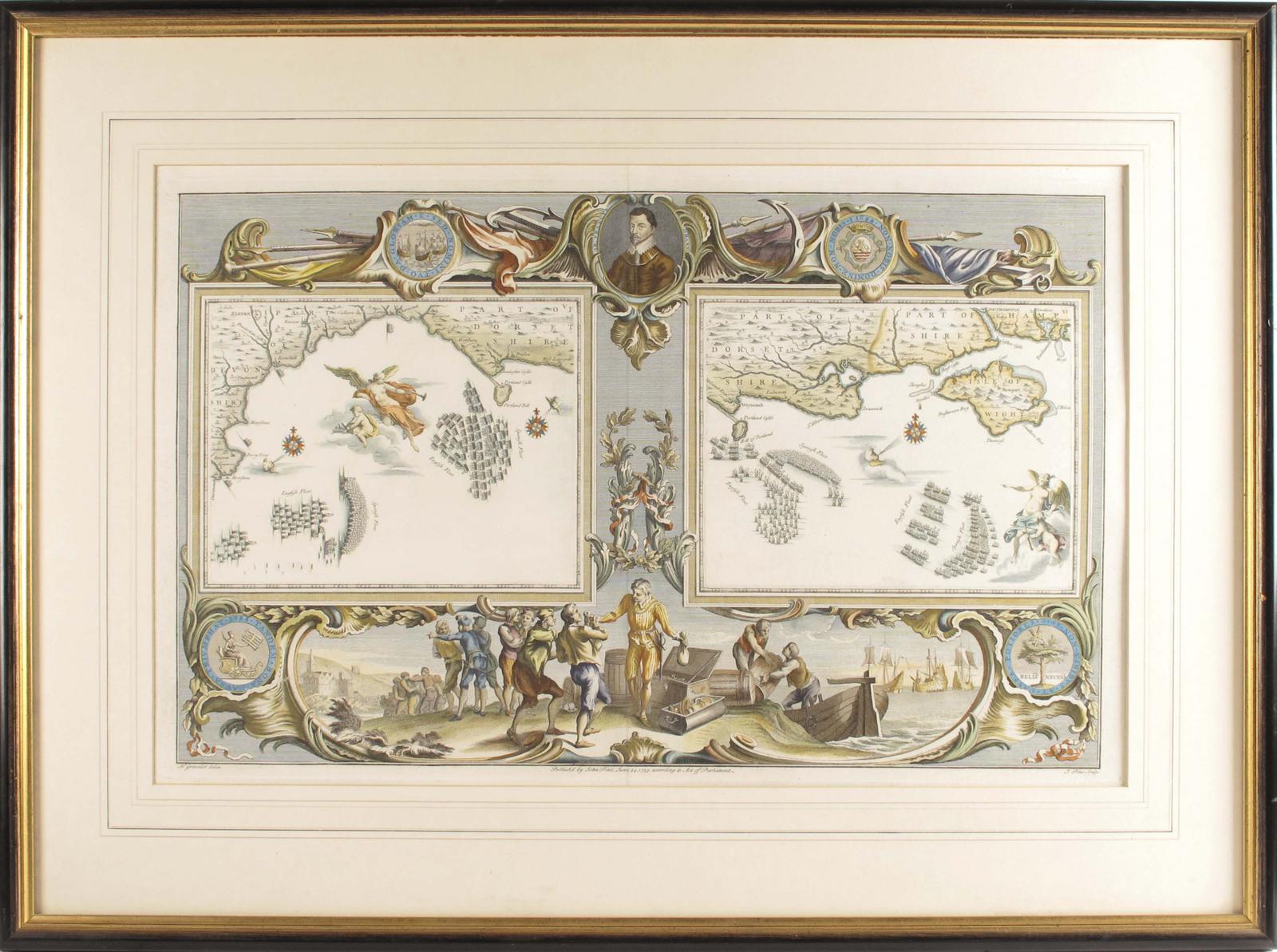
John Pine. 'A CHART showing the several Places of Action between the ENGLISH and SPANISH Fleets with the Places where several of the SPANISH Ships were destroyed in their return to SPAIN NORTH about the BRITISH ISLANDS', a hand coloured map engraved by H. Gravelot, and published by 'John Pine, June 24 1739 according to Act of Parliament', 15½ x 24½in (39.3 x 62cm) together with an accomapnying map of the progress of the English and Spanish fleets off the Dorset and Hampshire coasts, both later mounted, framed and glazed. (2)
Both these maps are taken from the famous tapestries that hung in the House of Lords charting the defeat of the Spanish Armada designed by Hendrick Vroom.